
Integrationen
GBIF-Arten in der Nähe
The app queries the published GBIF occurrence record around your current position and returns the taxa that have been recorded there, arranged in a taxonomic tree you can expand level by level and download from. It shows which groups are represented, how many distinct species (or higher taxa, at the detail level you choose) each group holds in the published record, and which names belong to those groups, before you start your own recording.
Aufrufen
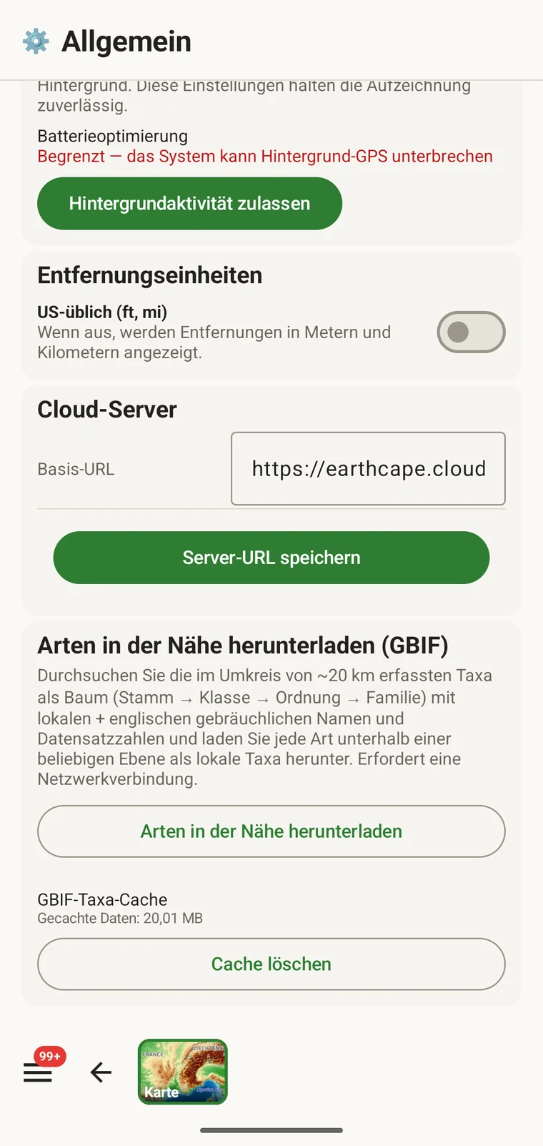
The entry point is the Download nearby species (GBIF) card under Menu → Admin → General; it is also offered during first-run setup. Scroll to the card and tap Download nearby species. The query runs against the live GBIF API, so you need a connection. Run it before you leave for the field, not once you have lost signal.
Was die Abfrage zurückgibt
The query looks at GBIF occurrence records within 20 km of your current position and groups them by phylum, giving for each phylum the number of distinct taxa at the chosen detail level (species by default). The sheet shows the top-level summary once Get data has run.
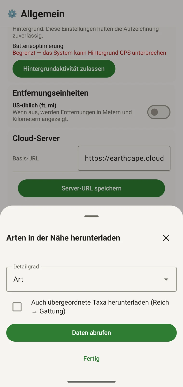
On opening, the sheet shows two controls and two buttons:
- Detail level (Phylum, Class, Order, Family or Species; Species is the default) — sets how far down the taxonomy the download goes when you tick a group.
- Also download parent taxa (kingdom → genus) checkbox — off by default; covered in its own section below.
- Get data — takes a GPS fix and loads the taxonomic tree for the area. Nothing is downloaded yet.
- Fertig — schließt das Blatt.
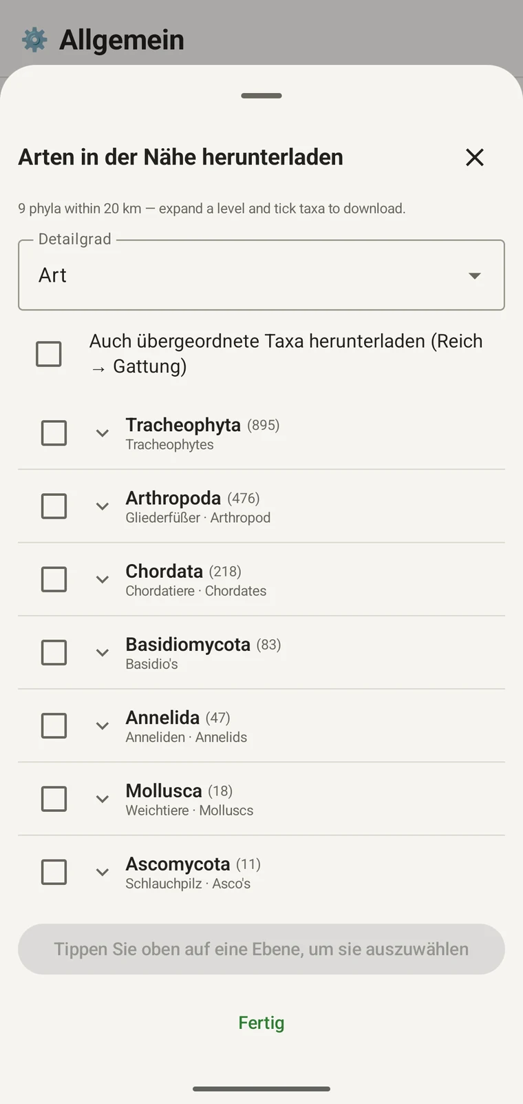
Once the tree has loaded the header reads, for example, "9 phyla within 20 km — expand a level and tick taxa to download.", a Select all row appears above the tree, and a Download N selected button replaces Get data.
Das Beispiel unten stammt aus einer Gebirgserhebung. Ihr eigener Standort liefert seine eigenen Zahlen.
| Stamm | Species within 20 km |
|---|---|
| Tracheophyta | 895 |
| Arthropoda | 476 |
| Chordata | 218 |
| Basidiomycota | 83 |
| Annelida | 47 |
| Mollusca | 18 |
| Ascomycota | 11 |
Ins Detail gehen
Tap a phylum to expand it to its constituent classes, and tap a class to expand to orders. At each level the number in brackets is the count of distinct taxa at the chosen detail level recorded under that group within the search radius. A count shown as 1,000+ has hit the query cap.
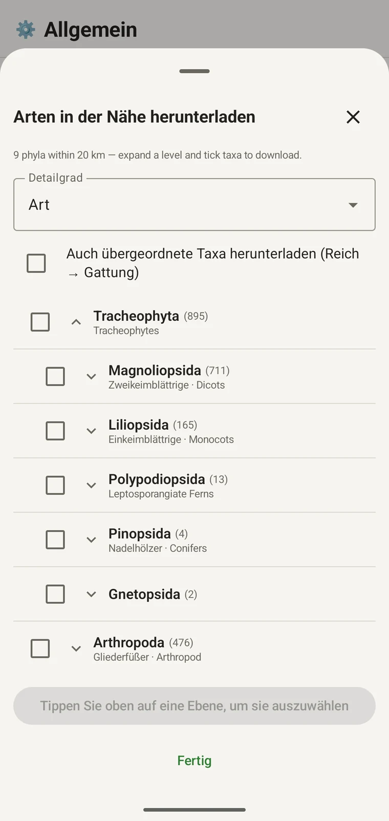
Weiter im selben Beispiel: Tracheophyta klappt auf zu Magnoliopsida 711, Liliopsida 165, Polypodiopsida 13, Pinopsida 4, Gnetopsida 2. Magnoliopsida aufgeklappt ergibt Asterales 115, Lamiales 100, Fabales 93, Rosales 56, Caryophyllales 49, jeweils mit ihrem Trivialnamen.
The counts are numbers of distinct taxa in the published record, not record totals and not abundance estimates. A high count means many taxa in that group have been recorded and published for this area; a low count means the group is either genuinely species-poor here or simply under-surveyed and under-published. The distinction matters when you use the figures to plan work — see the section on survey planning below.
Detailgrad und übergeordnete Taxa
The Detail level control sets the rank down to which taxa are downloaded when you tick a group. At Species, the download includes all species in GBIF's record for that group within the radius. If you are working at a coarser resolution — mapping genera only, for example — you can set the detail level to Family, Order, Class or Phylum to reduce the volume of names brought onto the device.
The Also download parent taxa (kingdom → genus) checkbox controls whether the higher ranks are fetched alongside the species. It is off by default; tick it in almost every case. Without it, the species names arrive on the device as orphans: the taxonomy held locally has no genus, family or order to attach them to, so they cannot be browsed by higher taxon and any rollup by group in your own data will not resolve correctly. Leave it off only if storage is genuinely tight and you intend to work entirely at species level with no hierarchical browsing.
Taxa auf das Gerät herunterladen
Nothing is pre-loaded onto the device for any particular site. The GBIF query populates the local taxonomy with GBIF Backbone names known to occur nearby, so when you record an observation you are picking from taxa that have actually been found at the site, rather than searching the full global list — and those names stay on the device once they are downloaded.
- Setzen Sie den Detailgrad auf den Rang, der Ihren Erfassungsanforderungen entspricht. Art ist der Standard.
- Tap Get data to load the tree for your position.
- Tippen Sie auf einen Stamm, um ihn aufzuklappen, und klappen Sie dann weiter bis zur gewünschten Klasse oder Ordnung auf.
- Haken Sie das Kontrollkästchen neben jeder Gruppe an, die Sie erfassen werden. Sie können auf jedem Rang anhaken — das Anhaken einer Klasse lädt alle zugehörigen Taxa bis zum eingestellten Detailgrad herunter.
- Tick Also download parent taxa unless storage is genuinely tight.
- Tap Download N selected. The app fetches the ticked taxa from GBIF and writes them to the local database in the background; a notification shows progress and you can close the sheet meanwhile.
- Tippen Sie auf Fertig, um das Blatt zu schließen.
Die heruntergeladenen Namen sind danach offline durchsuchbar, wenn Sie Beobachtungen eingeben (siehe Beobachtungen erfassen). Sie wählen aus Namen, die vor Ort bekannt sind, statt aus dem Gedächtnis gegen die vollständige weltweite Taxonomie zu tippen.
Damit eine Erhebung planen
Führen Sie vor einer Geländesaison die Abfrage über Ihren geplanten Standort aus und lesen Sie die Zahlen auf Stammebene, bevor Sie irgendetwas herunterladen. Die Verteilung der Zahlen sagt Ihnen, welche Gruppen im veröffentlichten Bestand für dieses Gebiet gut vertreten sind und welche kaum vorkommen.
A phylum with a handful of taxa is either genuinely absent from the site or under-surveyed and under-published there. Both cases are useful to know before a trip: genuine absence tells you where not to spend effort, and a thin published record for a group you expect to be present identifies a gap you can target.
Laden Sie Taxa nur für die Gruppen herunter, die Sie auf einer Tour aktiv erfassen werden. Es bringt nichts, den vollständigen Baum auf das Gerät zu laden, wenn Sie an einem einzigen Stamm arbeiten; der Download kostet Zeit und Bandbreite, die Sie vielleicht nicht haben.
Grenzen
Die Abfrage erfordert eine aktive Verbindung zur GBIF-API. Sie kann nicht offline laufen, weshalb der vorgesehene Ablauf lautet, sie an einem verbundenen Ort auszuführen, bevor Sie aufbrechen.
The search radius is 20 km around your current position. This is fixed by the query; there is no radius control in the app.
Die Zahlen geben wieder, was an GBIF veröffentlicht wurde. Die Abdeckung ist zwischen Regionen und zwischen taxonomischen Gruppen ungleich: Wirbeltiere in Westeuropa sind meist gut vertreten; Wirbellose und Pilze in Zentralasien nicht. Eine niedrige Zahl ist eine Aussage über den veröffentlichten Bestand für diese Kombination aus Gruppe und Ort, keine unmittelbare Aussage über den Standort. Deuten Sie die Zahlen mit diesem Vorbehalt.
Es gibt keine Veröffentlichung aus der App an GBIF. Die Integration ist rein lesend: Sie fragen vorhandene Datensätze ab und laden Taxonnamen herunter. Um eigene Daten zu GBIF beizutragen, exportieren Sie aus der App ein Darwin Core Archive oder eine GBIF-DwC-DP-Datei und reichen sie über den üblichen GBIF-Weg ein — die verfügbaren Dateiformate stehen unter Exportformate.