
Integraties
GBIF-soorten in de buurt
The app queries the published GBIF occurrence record around your current position and returns the taxa that have been recorded there, arranged in a taxonomic tree you can expand level by level and download from. It shows which groups are represented, how many distinct species (or higher taxa, at the detail level you choose) each group holds in the published record, and which names belong to those groups, before you start your own recording.
Het openen
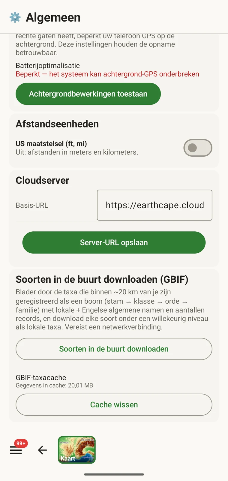
The entry point is the Download nearby species (GBIF) card under Menu → Admin → General; it is also offered during first-run setup. Scroll to the card and tap Download nearby species. The query runs against the live GBIF API, so you need a connection. Run it before you leave for the field, not once you have lost signal.
Wat de bevraging teruggeeft
The query looks at GBIF occurrence records within 20 km of your current position and groups them by phylum, giving for each phylum the number of distinct taxa at the chosen detail level (species by default). The sheet shows the top-level summary once Get data has run.
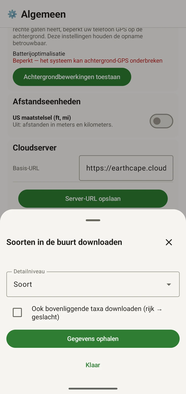
On opening, the sheet shows two controls and two buttons:
- Detail level (Phylum, Class, Order, Family or Species; Species is the default) — sets how far down the taxonomy the download goes when you tick a group.
- Also download parent taxa (kingdom → genus) checkbox — off by default; covered in its own section below.
- Get data — takes a GPS fix and loads the taxonomic tree for the area. Nothing is downloaded yet.
- Klaar — sluit het paneel.
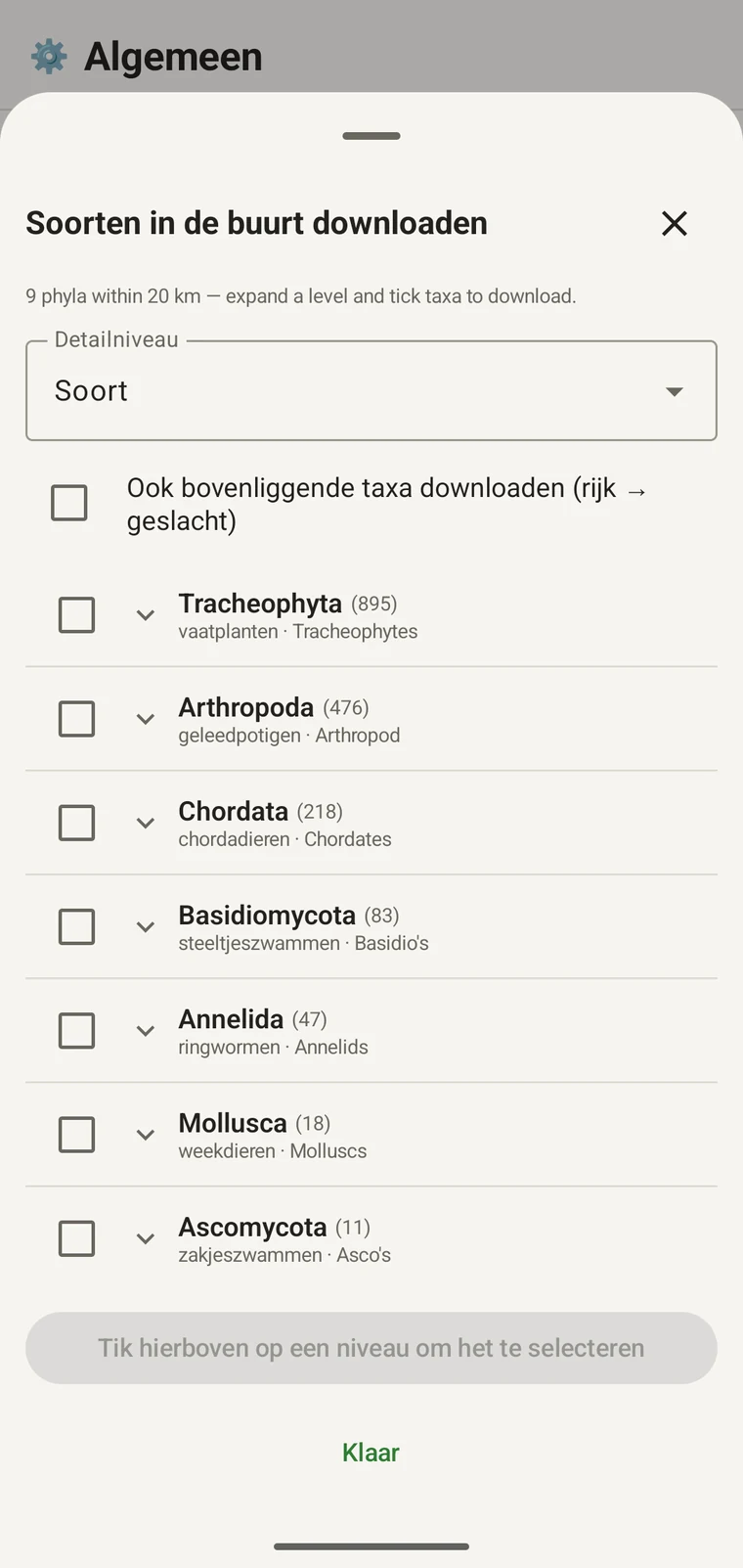
Once the tree has loaded the header reads, for example, "9 phyla within 20 km — expand a level and tick taxa to download.", a Select all row appears above the tree, and a Download N selected button replaces Get data.
Het onderstaande voorbeeld komt van een inventarisatie in de bergen. Uw eigen locatie levert eigen cijfers op.
| Stam | Species within 20 km |
|---|---|
| Tracheophyta | 895 |
| Arthropoda | 476 |
| Chordata | 218 |
| Basidiomycota | 83 |
| Annelida | 47 |
| Mollusca | 18 |
| Ascomycota | 11 |
Verder uitvouwen
Tap a phylum to expand it to its constituent classes, and tap a class to expand to orders. At each level the number in brackets is the count of distinct taxa at the chosen detail level recorded under that group within the search radius. A count shown as 1,000+ has hit the query cap.
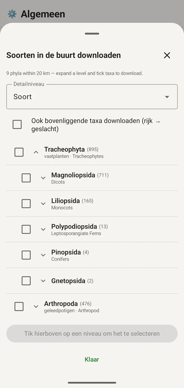
In het vervolg van hetzelfde voorbeeld: Tracheophyta vouwt uit naar Magnoliopsida 711, Liliopsida 165, Polypodiopsida 13, Pinopsida 4, Gnetopsida 2. Magnoliopsida uitvouwen geeft Asterales 115, Lamiales 100, Fabales 93, Rosales 56, Caryophyllales 49, elk weergegeven met de volksnaam.
The counts are numbers of distinct taxa in the published record, not record totals and not abundance estimates. A high count means many taxa in that group have been recorded and published for this area; a low count means the group is either genuinely species-poor here or simply under-surveyed and under-published. The distinction matters when you use the figures to plan work — see the section on survey planning below.
Detailniveau en bovenliggende taxa
The Detail level control sets the rank down to which taxa are downloaded when you tick a group. At Species, the download includes all species in GBIF's record for that group within the radius. If you are working at a coarser resolution — mapping genera only, for example — you can set the detail level to Family, Order, Class or Phylum to reduce the volume of names brought onto the device.
The Also download parent taxa (kingdom → genus) checkbox controls whether the higher ranks are fetched alongside the species. It is off by default; tick it in almost every case. Without it, the species names arrive on the device as orphans: the taxonomy held locally has no genus, family or order to attach them to, so they cannot be browsed by higher taxon and any rollup by group in your own data will not resolve correctly. Leave it off only if storage is genuinely tight and you intend to work entirely at species level with no hierarchical browsing.
Taxa naar het apparaat downloaden
Nothing is pre-loaded onto the device for any particular site. The GBIF query populates the local taxonomy with GBIF Backbone names known to occur nearby, so when you record an observation you are picking from taxa that have actually been found at the site, rather than searching the full global list — and those names stay on the device once they are downloaded.
- Stel Detailniveau in op de rang die bij uw registratiebehoefte past. Soorten is de standaardinstelling.
- Tap Get data to load the tree for your position.
- Tik op een stam om die uit te vouwen en vouw daarna verder uit tot de klasse of orde die u wilt.
- Vink het selectievakje aan naast elke groep die u gaat registreren. U kunt op elke rang aanvinken — een klasse aanvinken downloadt alle taxa waaruit die bestaat, tot aan het detailniveau dat u hebt ingesteld.
- Tick Also download parent taxa unless storage is genuinely tight.
- Tap Download N selected. The app fetches the ticked taxa from GBIF and writes them to the local database in the background; a notification shows progress and you can close the sheet meanwhile.
- Tik op Klaar om het paneel te sluiten.
De gedownloade namen zijn daarna offline doorzoekbaar wanneer u waarnemingen invoert, zie Waarnemingen registreren. U kiest uit namen waarvan bekend is dat ze lokaal voorkomen, in plaats van uit het hoofd te typen tegen de volledige wereldwijde taxonomie.
Het gebruiken om een inventarisatie te plannen
Voer de bevraging vóór een veldseizoen uit op de locatie die u op het oog hebt en lees de aantallen op stamniveau voordat u iets downloadt. De verdeling van de aantallen vertelt u welke groepen goed vertegenwoordigd zijn in de gepubliceerde gegevens voor dat gebied en welke nauwelijks aanwezig zijn.
A phylum with a handful of taxa is either genuinely absent from the site or under-surveyed and under-published there. Both cases are useful to know before a trip: genuine absence tells you where not to spend effort, and a thin published record for a group you expect to be present identifies a gap you can target.
Download alleen taxa voor de groepen die u tijdens een bepaalde tocht daadwerkelijk gaat registreren. Het heeft geen zin de volledige boom op het apparaat te laden als u aan één stam werkt; de download kost tijd en bandbreedte die u misschien niet hebt.
Beperkingen
De bevraging vereist een live verbinding met de GBIF-API. Ze kan niet offline draaien, en daarom is de bedoelde werkwijze om haar uit te voeren voordat u een plek met verbinding verlaat.
The search radius is 20 km around your current position. This is fixed by the query; there is no radius control in the app.
De aantallen weerspiegelen wat aan GBIF is gepubliceerd. De dekking is ongelijk tussen regio's en tussen taxonomische groepen: gewervelden in West-Europa zijn doorgaans goed vertegenwoordigd, ongewervelden en fungi in Centraal-Azië niet. Een laag aantal zegt iets over de gepubliceerde gegevens voor die combinatie van groep en locatie, en niet rechtstreeks iets over de locatie zelf. Interpreteer de cijfers met dat in gedachten.
Er wordt vanuit de app niets naar GBIF gepubliceerd. De integratie is alleen-lezen: u bevraagt bestaande gegevens en downloadt taxonnamen. Om uw eigen gegevens aan GBIF bij te dragen, exporteert u vanuit de app een Darwin Core Archive- of GBIF DwC-DP-bestand en dient u dat via de gebruikelijke GBIF-route in — zie Exportformaten voor de beschikbare bestandsformaten.