
Data
Export formats
EarthCape writes to twelve formats — biodiversity archives, spatial files, spreadsheets and a full database backup — directly on the device, with no account and no connection required. Cloud destinations need a connection. They are the formats a repository, a GIS or a colleague will accept without conversion.
The export screen
Select a project first. The export screen is at Menu → Admin → File Import & Export. The screen is divided into two sections. At the top is Import & restore, with a single entry, Import data package…, which reads a Frictionless Data Package — one you exported earlier, or one a colleague sends you. Below it is the Export grid, which lists all twelve formats by name and file extension. Tap a format to begin.
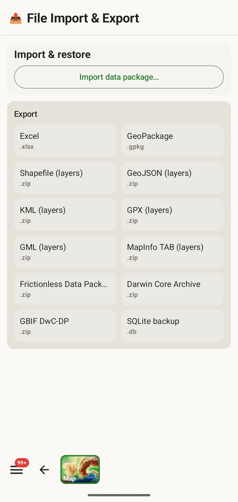
The twelve formats
All twelve formats are written on the device. There is no server involved and no connection required.
| Format | File | What it is for |
|---|---|---|
| Excel | .xlsx | A spreadsheet workbook for colleagues who work in Excel or similar tools |
| GeoPackage | .gpkg | A single-file OGC spatial container, the best default for QGIS or ArcGIS |
| Shapefile (layers) | .zip | ESRI Shapefile set, one layer per entity type, in a zip archive |
| GeoJSON (layers) | .zip | RFC 7946 GeoJSON, one file per entity type, in a zip archive |
| KML (layers) | .zip | Keyhole Markup Language for Google Earth and KML-capable tools, in a zip archive |
| GPX (layers) | .zip | GPS Exchange Format for GPS devices and track tools, in a zip archive |
| GML (layers) | .zip | Geography Markup Language, an OGC XML format, in a zip archive |
| MapInfo TAB (layers) | .zip | MapInfo interchange files (MIF/MID) for MapInfo Pro, in a zip archive |
| Frictionless Data Package | .zip | A self-describing tabular package with a datapackage.json descriptor, suited for repository deposits and data papers |
| Darwin Core Archive | .zip | The standard ingestion format for GBIF and most biodiversity repositories |
| GBIF DwC-DP | .zip | The newer GBIF data package model, for submissions that require it |
| SQLite backup | .db | A complete copy of the app's on-device database, all projects included |
Biodiversity standards
Darwin Core Archive is the format GBIF and most biodiversity repositories ingest. Occurrence records are mapped to Darwin Core terms and packaged with a meta.xml descriptor, so a repository can import the archive without further transformation. GBIF DwC-DP is the newer GBIF data package model — a set of linked CSV tables (events, occurrences, material and media), intended for submissions that require it or prefer a tabular representation over the archive format. Frictionless Data Package produces a self-describing zip of CSV tables plus a datapackage.json descriptor. It is a good choice for a repository deposit accompanying a data paper, or for any workflow that expects a Frictionless data package alongside the tables.
Spatial formats
GeoPackage is a single .gpkg file that holds all entity types in separate layers inside an SQLite container — the OGC standard for portable spatial data and the best default choice for QGIS or ArcGIS. The remaining spatial formats — Shapefile, GeoJSON, KML, GPX, GML and MapInfo TAB — are marked "(layers)" because they cannot express multiple feature types in a single file. Each one is exported as a .zip archive containing one file (or file set, for Shapefile) per entity type: observations, localities, visits (with their routes), diary entries and specimens. Unzip the archive before loading it into your GIS.
General
Excel (.xlsx) produces a workbook, one worksheet per entity, for a colleague who works in a spreadsheet. SQLite backup (.db) is a raw copy of the app's whole database — every project — for archiving or for opening in any SQLite tool. It cannot be imported back into the app; to move data between devices use the Frictionless Data Package with Import data package…, or Backup & Restore under Menu → Admin → Account.
Exporting
- Select the project you want to export from the home screen.
- Open Menu → Admin → File Import & Export.
- Tap the format you want from the Export grid.
- Wait while the file is written. Larger projects with photos take longer; the screen shows progress.
- When writing is complete, the Android share sheet appears so you can choose where the file goes. A Save to Downloads action is also offered if you prefer to keep the file on the device.
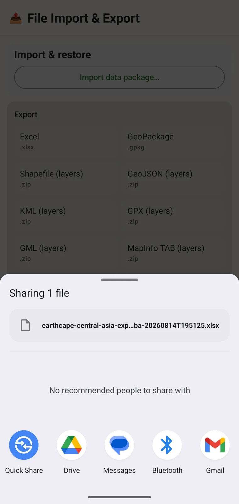
Filenames are generated from the project name and a timestamp, for example earthcape-central-asia-exp…ba-20260814T195125.xlsx. Each export gets a unique name, so repeated exports of the same project do not overwrite each other.
Where the file goes
Once the file is written, the Android share sheet opens with the usual destinations: Quick Share, Drive, Messages, Bluetooth, Gmail, and any other app registered on your device that accepts files. You can share the export immediately, or save it locally and upload later. If you have configured a cloud destination (see below), you can export the project there directly from its Integrations page instead of using the share sheet.
Cloud destinations
Three cloud destinations are available under Menu → Admin → Integrations: Google Drive, Dropbox and Zenodo. Open a provider's page to sign in and to export the current project there; the export screen itself writes local files only.
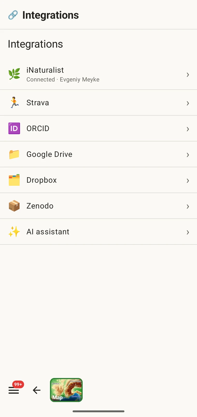
Google Drive and Dropbox are suited to working files and team collaboration — you put the export in a shared folder and a colleague picks it up. Zenodo is a research repository run by CERN that issues a DOI for each deposit, making it appropriate for a citable archived data release alongside a publication. See Google Drive collaboration for the full collaboration workflow using Drive.
No publishing to GBIF. EarthCape does not submit records to GBIF directly. To contribute to GBIF, export a Darwin Core Archive and submit it through your institution or a GBIF-endorsed data publisher.
Project packages: import and restore
The Import data package… entry at the top of the screen handles a different kind of file: a project package. A project package carries the configuration of a project — its protocol, form layout, custom fields and settings — so you can hand a configured project to a colleague, or move a project to a new device without losing the setup.
Project packages are distinct from data exports. They are not intended for import into a GIS or a repository; they are for moving a configured working environment from one installation to another. Custom field definitions, protocol choices and form layout all travel with the package. See Forms and custom fields for how custom fields work and Survey protocols for protocol configuration.
Choosing a format
The right format depends on what you are doing with the data.
| Destination or use | Format to choose |
|---|---|
| Submitting to GBIF or a biodiversity repository | Darwin Core Archive, or GBIF DwC-DP if the repository requires it |
| Opening in QGIS or ArcGIS | GeoPackage — a single file, all layers included |
| Sending to a colleague who uses spreadsheets | Excel |
| Data-paper deposit or repository with a schema requirement | Frictionless Data Package |
| Full backup or moving to another device | SQLite backup |
| GPS device or another track application | GPX |
| Viewing in Google Earth | KML |
| Citable archived deposit with a DOI | Any format sent to Zenodo |
Working offline
All twelve formats are written entirely on the device. No connection is needed to export: the file is assembled from the local database and written to local storage. Only the cloud destinations — Drive, Dropbox, Zenodo — require a signal to complete the upload. If you are in the field without connectivity, export to a local file now and send it to a cloud destination later, once you have a connection.