Map and terrain
Map and tile server
The basemap is a vector rendering of the whole planet, built from OpenStreetMap through the OpenMapTiles schema and served from infrastructure we run ourselves. Because the vector basemaps involve no third-party map provider, the map features in the app are free, work offline, and need nothing configured.
Where the tiles come from
Most field apps license their map from someone else. They hold a Google Maps or Mapbox key, pay per tile loaded, and pass the cost and the limits on: an API key to register, a monthly quota, a cap on how much can be cached for offline use, and a third party that sees every area you look at.
EarthCape renders and hosts the planet itself. There is no key to register, no quota to exhaust, no cap on offline downloads, and tile requests go to our servers rather than to an advertising network. It also removes the licence restriction that normally limits offline caching, so the amount of map you can take into the field is bounded only by device storage.
| Property | What it means in the field |
|---|---|
| Source data | OpenStreetMap, rendered through the OpenMapTiles schema, plus terrain elevation |
| Coverage | The entire planet, at every zoom level the app offers |
| Tile format | Vector tiles, so the map is drawn on the device rather than downloaded as pictures |
| API key | None. Nothing to register, paste in, or renew mid-season |
| Cost | None. No per-tile billing and no usage cap |
| Offline limit | Your device storage. There is no licence restriction on how much you cache |
| Tracking | Tile requests go to our servers only |
Vector, not pictures. Because tiles carry the features rather than a rendered image, the same download drives the map, the feature legend, trail snapping and 3D terrain. Those tools therefore work without a network connection, and an offline area is measured in tens of megabytes rather than gigabytes.
The map screen
The map opens on your current position with the project's records drawn over it. The toolbar along the top carries everything the map can do.

| Toolbar item | What it opens |
|---|---|
| Menu | The app's navigation drawer |
| Topo | The basemap picker: topographic, streets, satellite |
| Legend | The feature legend for the point you tap, described in Map tools |
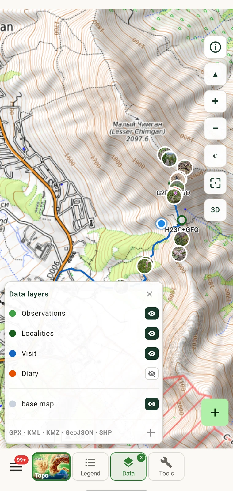
| Data | Which of your own layers are drawn: observations, localities, visits, tracks, base map |
| Tools | Measure, search, brightness and offline maps |
Basemap styles
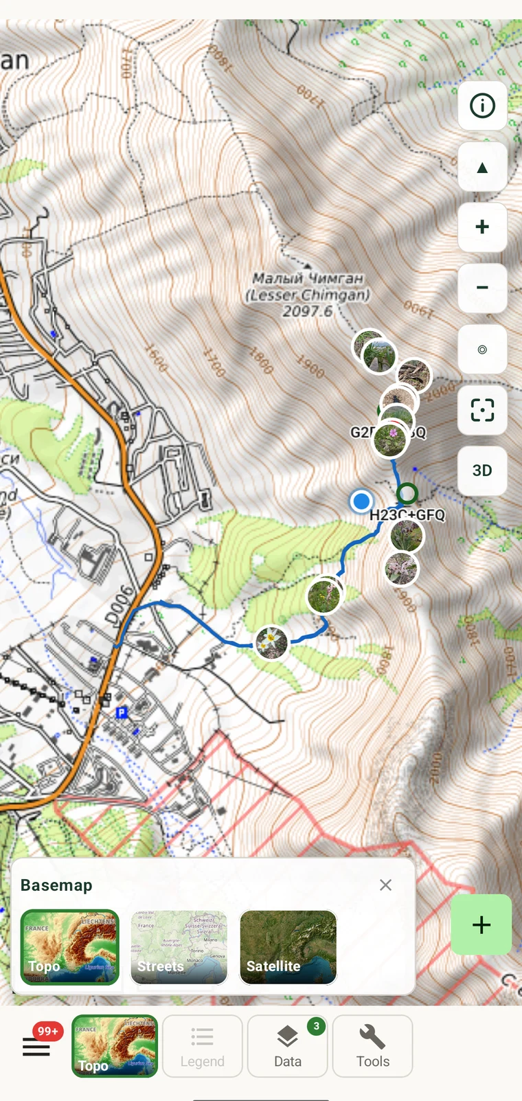
Tap Topo in the toolbar to change the basemap. All three styles come from the same tile server, and all three are available offline once an area is downloaded.
Topographic
The default, and the one built for field work. Carries contour lines with height labels, hillshade relief, land cover, water, and the path and track network that measurement snapping uses.
Streets
A cleaner rendering with roads, settlements and labels emphasised. Useful when navigating to a site rather than working on it.
Satellite
Aerial imagery, for reading canopy structure and ground cover that a vector map cannot show.
Terrain and 3D
The topographic style carries relief in two forms. Contours are drawn as labelled lines at intervals that change with zoom. Hillshade shades the slopes so the shape of the ground is visible directly.
Drag with two fingers to tilt the map into 3D. Terrain elevation is applied to the surface, so ridges, valleys and the profile of a massif stand up. Twist with two fingers to rotate. Terrain data is included in offline downloads, so 3D works with no connection.
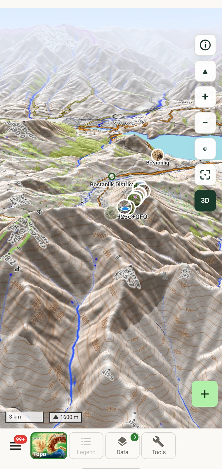
On a tablet the same 3D view has enough width to show a whole massif in one view, and the toolbar sits on the map rather than behind a sheet. See Tablet layout.
Marker styling
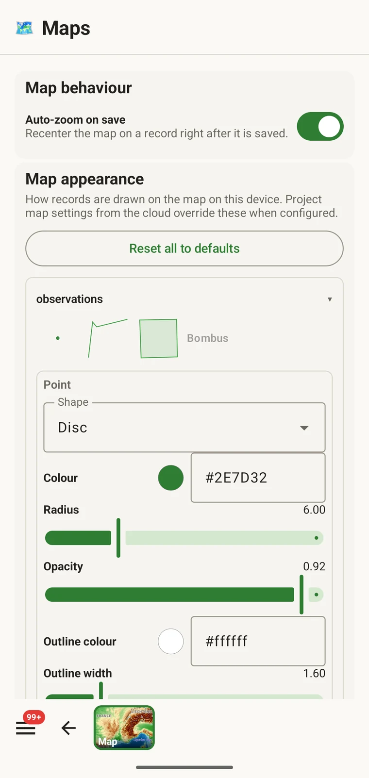
How your records are drawn on the map is configurable per entity type. Open the map settings to set the shape, fill colour, radius, opacity, outline colour and outline width used for observations, localities and visits.
The Auto-zoom on tap setting controls whether tapping a marker moves the map to it. Turn it off if you are working at a fixed scale and do not want the view to jump.