
The app
Tablet layout
On a tablet you are running the same app against the same database. What changes is the arrangement: on a landscape screen the layout opens out into panes side by side instead of stretching a single column across the width. Nothing is added, nothing is taken away, and a project moves between a phone and a tablet unchanged.
The dashboard
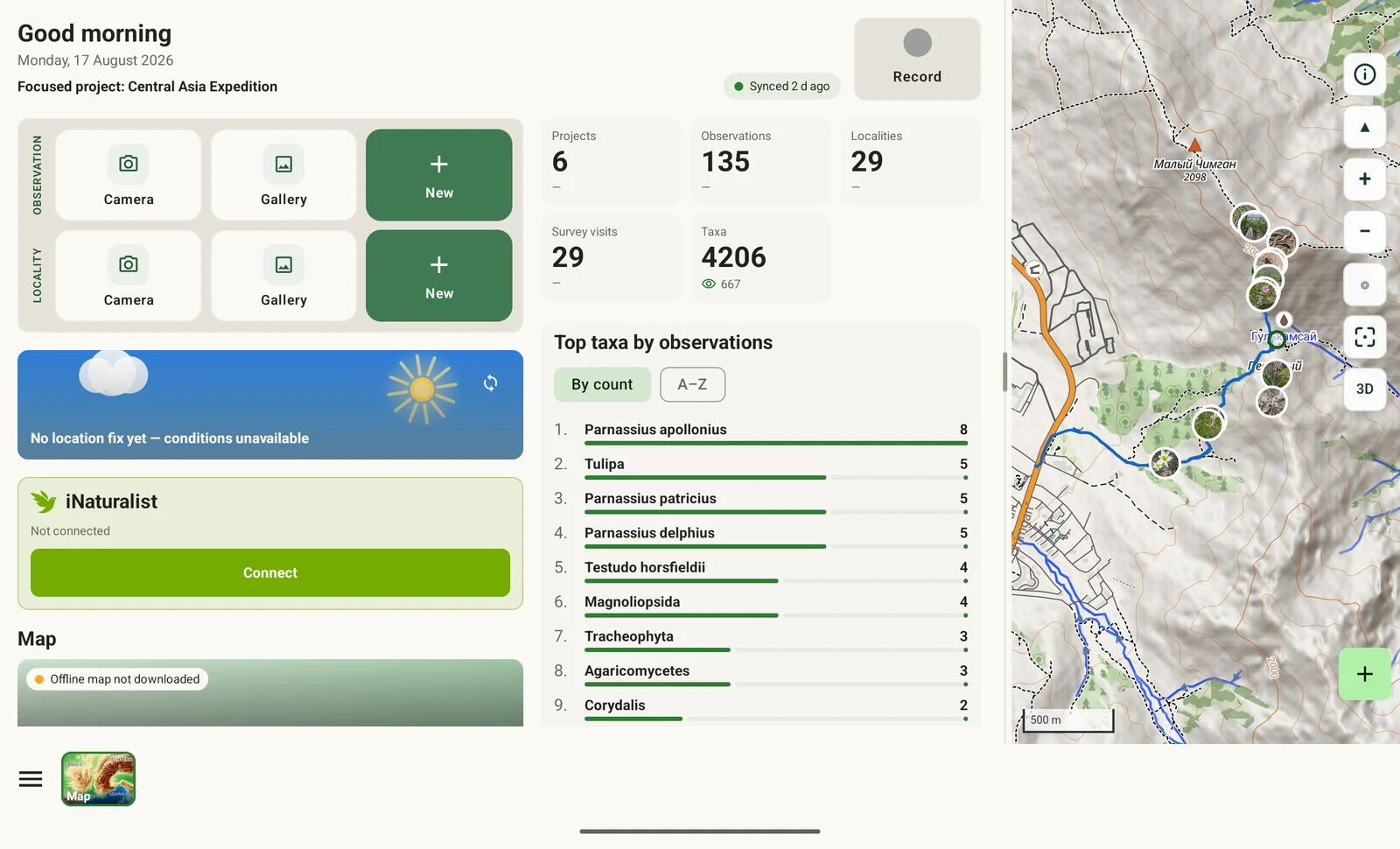
In landscape the home screen divides into three panes shown at once, rather than one list you scroll through. The counts, the project summary and the working list are visible together, so moving between them takes no navigation step.
The map
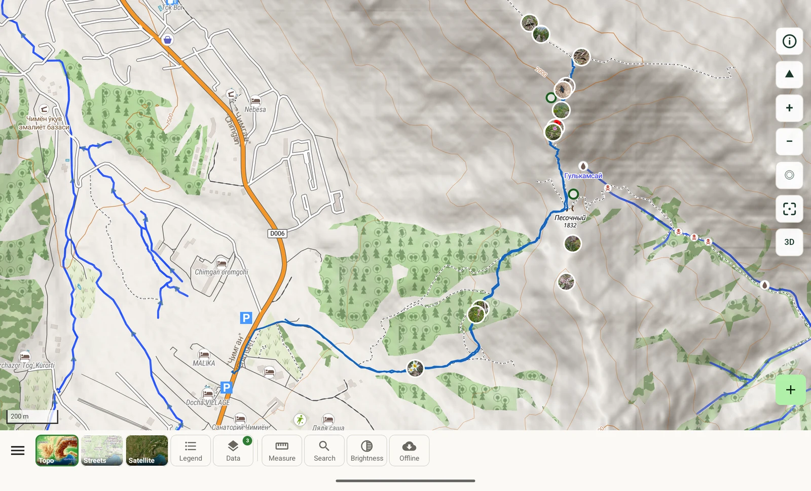
The map gains two things on a wide screen. The first is the toolbar: on a tablet it sits inline on the map rather than behind a sheet, so the basemap picker, the feature legend, the data layers and the tools are one tap away instead of two. These are controls you use repeatedly during a working day rather than set once.
The second is visible area. At the same zoom level a landscape screen shows a substantially larger extent. This matters most in two cases: measuring, where you want the whole of a transect or a plot boundary in view while you place vertices (see Map tools), and 3D, where a tilted view spends much of its height on the horizon.
3D terrain on a wide screen
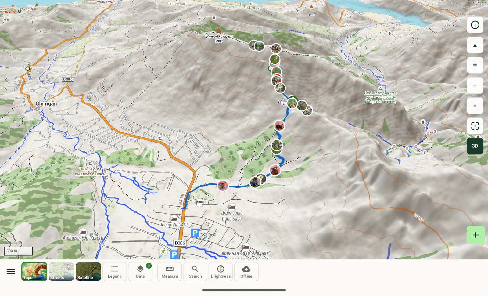
Tilted into 3D, a landscape screen holds a whole massif in one view: the ridge line, the valleys below it and the reservoir beyond. On a phone you see the same scene in sections. The terrain model and the controls are identical — two-finger drag to tilt, two-finger twist to rotate — and terrain elevation is part of the offline download, so this works with no connection. The underlying map is described in Map and tile server.
Recording
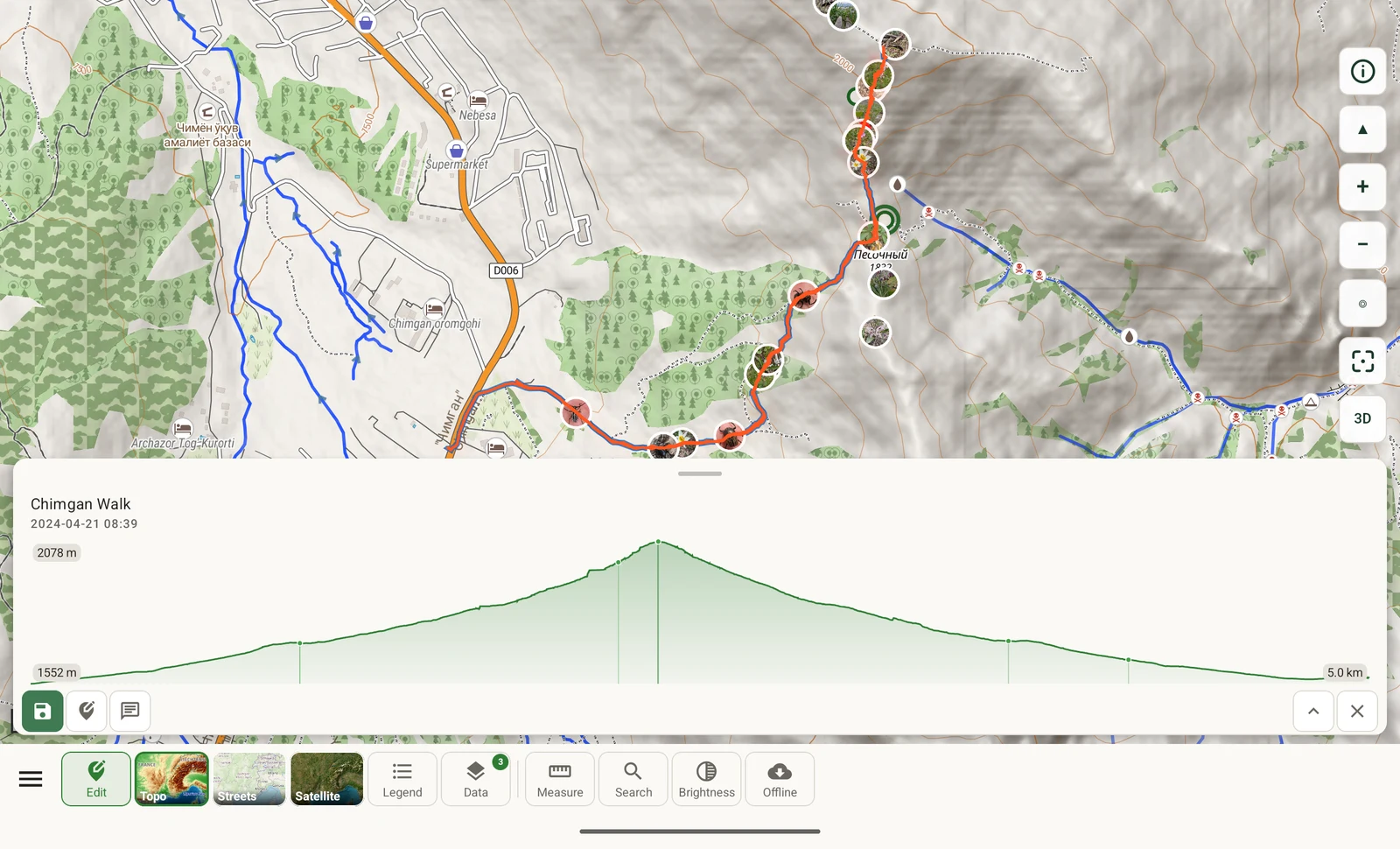
When you record on a tablet the map and the record card stay on screen together. You can see where a record is being placed while you are typing it, rather than switching back and forth to check. The GPS status, the project the record is filed under and the entry fields all sit beside the position they refer to.
This is the same recording workflow documented in Recording observations — the same GPS readout, the same visit prompt, the same forms. Only the arrangement differs.
Split panes and the splitter
Wherever the phone shows a list and then a detail view as two screens, the tablet shows them side by side: the list on one side, the selected record on the other. Selecting a row updates the detail pane in place, so you can work down a list without losing your position in it.
The divider between the panes is draggable. It is labelled Resize map pane where it separates a map from a list. Pull it either way to give one side more room:
- Widen the map when you are working spatially: measuring, checking where a track ran, or reviewing how records are distributed over a site.
- Widen the list when you are working with data: comparing rows, checking a column you have added, or correcting entries against your notes.
The position you drag it to is where it stays, so you can set it once for the kind of work you are doing rather than adjusting it each time.
What is identical to the phone
The tablet layout is not a separate edition of the app. No feature exists on one form factor and not the other.
| Component | On a tablet |
|---|---|
| Database | The same on-device database, with no account required |
| Protocols | The same seven protocols, editable, plus any you write in the protocol studio |
| Forms and custom fields | The same form designer, the same field layout and the same custom fields |
| Export | The same twelve export formats, producing the same files |
| Offline maps | The same region downloads, the same world map, the same offline mode |
| Integrations | The same list: iNaturalist, ORCID, Google Drive, Dropbox, Zenodo and the AI assistant |
| GBIF nearby species | Unchanged, including the taxonomic tree and the detail level setting |
Project packages move between devices. Form layouts, custom fields and protocol configuration travel as a project package you export from one device and import on another, as described in Forms and custom fields. A package built on a phone imports on a tablet with no conversion, and the reverse holds too. That is how you set a survey up once and hand it to a team carrying mixed hardware.
Which device to take
A phone suits recording while you are moving: it works one-handed and fits a pocket between records, which is what a walked transect requires. A tablet suits stationary work where you need to see more than one thing at a time — in a vehicle between sites, at a base camp in the evening, or when reviewing and correcting a day's records against field notes, where having a list and a map visible together saves time.
Records made on either device export identically, and a shared Google Drive folder gives a team a common place to put contributions and pull down a merged copy, whatever hardware each person is carrying.