
Map and terrain
Offline maps
Because EarthCape runs its own tile server, as described in Map and tile server, there is no licence restriction on how much of the map you cache. The only limit is your device storage. Downloads range from a single district to the whole planet, and include every basemap style, contour layer, hillshade and 3D terrain model.
Opening the offline maps panel
On the map screen, tap Tools in the top toolbar. The Tools sheet slides up. Tap Offline to open the offline maps panel.
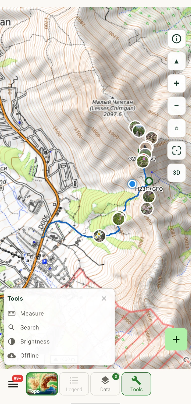
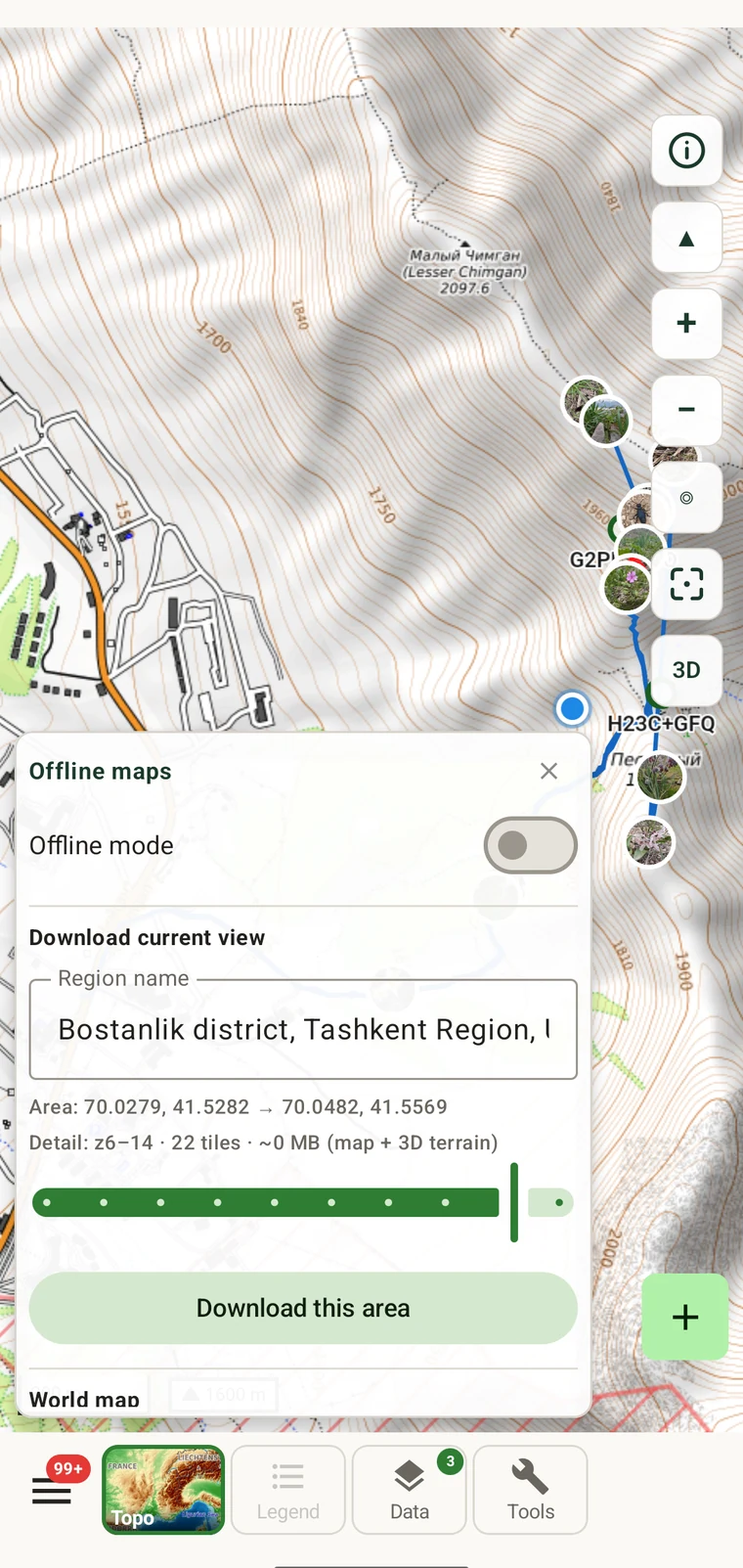
The panel contains the following controls:
| Element | What it does |
|---|---|
| Offline mode | Toggle that stops the app making any tile network requests. When on, only cached tiles are used. |
| Download current view | Section header for the area download controls below it. |
| Region name | Auto-filled from place names covering the current map view, for example "Bostanlik district, Tashkent Region, Uzbekistan". You can edit it. |
| Area coordinates | The bounding box of the current view, shown as two coordinate pairs: the south-west and north-east corners. For example: 69.9728, 41.4430 → 70.1142, 41.6429. |
| Detail line | The zoom range and estimated size of the download, for example: z6–14 · ~22 MB (approx · map + 3D terrain). |
| Download this area | Button that begins the download for the region shown. |
| World map row | A separate fixed entry: World map — Detail: z0–5 · ~40 MB, with its own Download world map button. |
Downloading a working area
Navigate the map to the area you intend to cover, then download it before you leave for the field.
- Pan and zoom the map so the area you will be working in fills the screen. The download covers exactly what is visible, so frame it to include any approach routes and margins you might need.
- Open Tools → Offline. The panel reads the current view immediately.
- Check the region name. It is filled in from place names, for example "Bostanlik district, Tashkent Region, Uzbekistan". Edit it if you want something more specific — this name appears in your list of stored regions later.
- Read the Area line to confirm the bounding box matches what you intended.
- Read the Detail line. It will show something like
z6–14 · ~22 MB (approx · map + 3D terrain). The size estimate is shown here so you can check available storage before committing. The download covers zoom levels 6 through 14, which gives a usable overview of the region down to fine path-level detail. It includes the 3D terrain model, not only the basemap tiles, so hillshade, contours and 3D tilt all work offline within the area. - Tap Download this area. The download runs in the background.
A larger area or one with more mountainous terrain takes more storage, because the terrain model accounts for a significant portion of the download. The size estimate shown in the Detail line reflects the actual area selected, so check it for each region you download. For a district-sized area at z6–14, roughly 22 MB is typical.
The world overview
The world map entry in the offline panel downloads zoom levels 0 through 5 for the entire planet, at approximately 40 MB. This is a coarse view: you can see continents, countries, major cities and large mountain ranges, but not local paths or individual buildings.
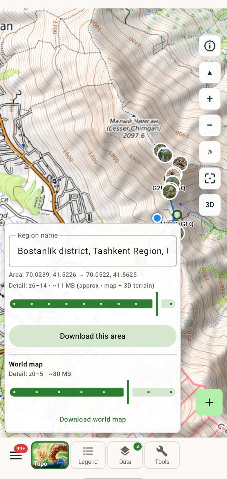
The world overview is worth downloading even if you already have regional areas. It costs very little in storage and means the map is never blank when you fly to a new country, pan outside a downloaded region, or open the app before downloading a specific area. Without it, those situations show an empty grey screen where the basemap should be.
Offline mode
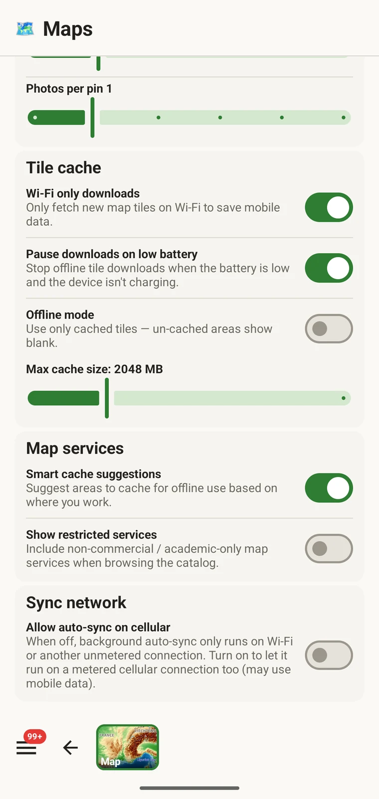
The Offline mode toggle in the panel stops the app from making any tile network requests at all. When it is on, the map draws only from the tiles already cached on the device and ignores the network entirely.
You do not need to switch this on for offline areas to work — downloaded tiles are served from the device by default whenever a connection is unavailable. The toggle exists for a different situation: a weak or roaming mobile signal is often slower than no signal, because the app sends tile requests that take a long time to time out rather than failing immediately. In mountainous terrain with intermittent coverage this shows as the map loading slowly or stalling. Switching offline mode on eliminates those requests, and the map responds as fast as if you were in full coverage. It also stops the radio retrying failed requests, which saves battery on a long recording day.
Turn offline mode off again when you return to a reliable connection and want the map to update around areas you have not downloaded.
Managing stored regions
To see what you have downloaded, open Tools → Offline and scroll down past the download controls. The stored regions list shows each named area, how much storage it uses, and a button to remove it.
Remove a region when you have finished with it and want to reclaim storage. The region name you gave when downloading is what identifies it in the list, so descriptive names help when you have several regions across different field seasons or sites.
Check your available storage before a long trip. Mobile devices vary considerably in how much free space they have, and downloading a set of regions for a whole season is something you want to do while you still have time to free space if needed.
What works offline
Most of the app's core features require no connection once data is on the device. A small number of features that by their nature reach external services require a connection to function, and they queue or wait rather than failing silently.
| Works with no connection | Needs a connection |
|---|---|
|
These features queue or simply wait until you have signal. Nothing is lost — exports you have already generated are on the device, and your recorded data is stored locally regardless of connection state. |
Storage planning
Two figures come directly from the app. Everything else below is derived from them.
| Area | Zoom levels | Size |
|---|---|---|
| World overview | z0–5 | ~40 MB |
| District-sized area (e.g. Bostanlik district) | z6–14 | ~22 MB |
| Several working districts, one field season | z6–14 each | Comfortably under a gigabyte |
| A larger mountain range or national park | z6–14 | Roughly comparable to several district downloads |
A typical field season covering several districts — the world overview plus a handful of regional downloads — will come to well under a gigabyte in total. Modern phones have 64 GB or more of storage, so offline maps are rarely a constraint in practice. The size estimate in the offline panel is shown before you commit to a download, so you can check for any unusually large area before it begins.
Download before you leave, not at the trailhead. Mobile signal at a trailhead or field site is often the weakest it will be on your trip. Downloading a region over a slow connection is slow, and some sites have no connection at all. Do your downloading at home, at the office, or wherever you have a reliable connection.