
資料
匯出格式
EarthCape writes to twelve formats — biodiversity archives, spatial files, spreadsheets and a full database backup — directly on the device, with no account and no connection required. Cloud destinations need a connection. They are the formats a repository, a GIS or a colleague will accept without conversion.
匯出畫面
Select a project first. The export screen is at Menu → Admin → File Import & Export. The screen is divided into two sections. At the top is Import & restore, with a single entry, Import data package…, which reads a Frictionless Data Package — one you exported earlier, or one a colleague sends you. Below it is the Export grid, which lists all twelve formats by name and file extension. Tap a format to begin.
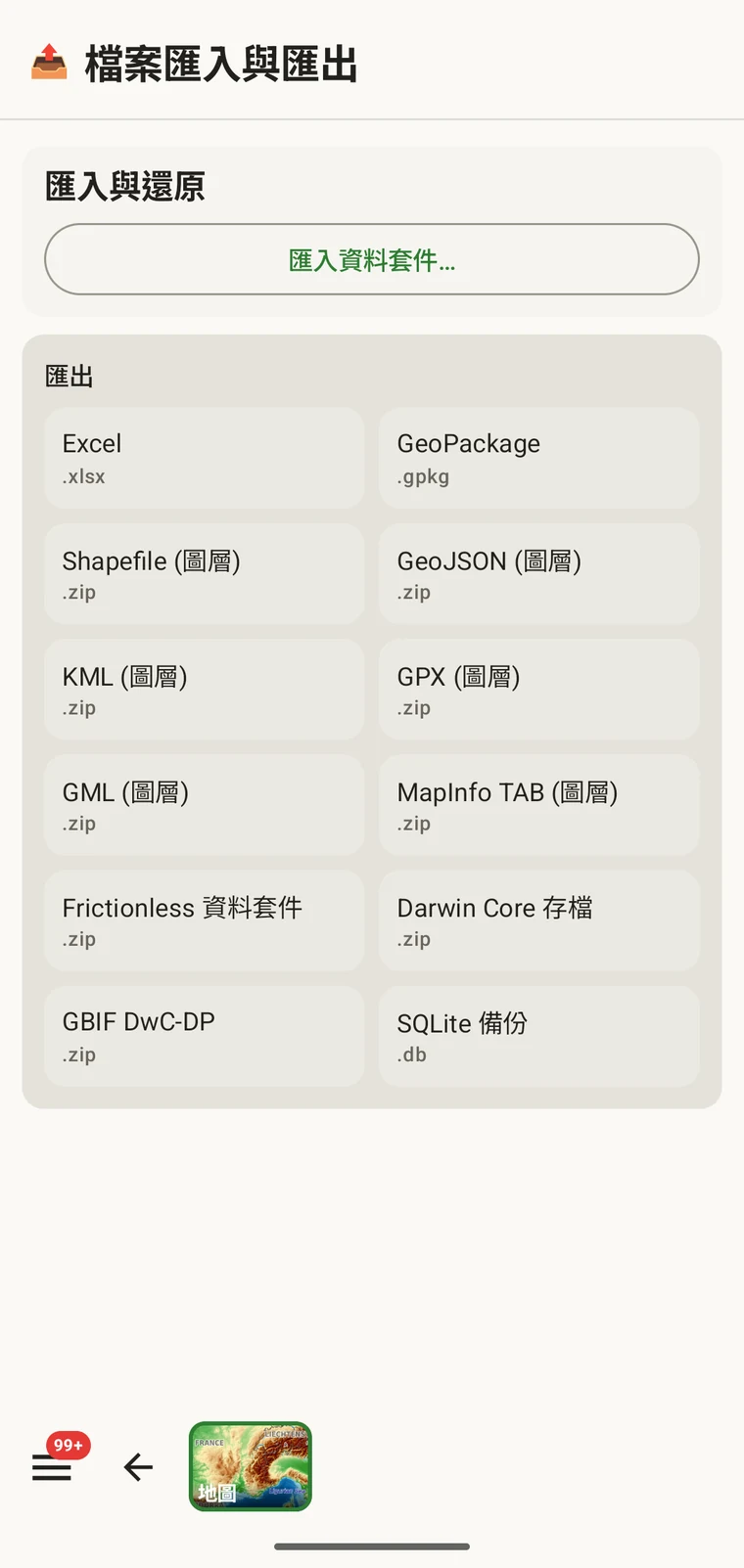
十二種格式
全部十二種格式都在裝置上寫出。過程中不涉及伺服器,也不需要連線。
| 格式 | 檔案 | 用途 |
|---|---|---|
| Excel | .xlsx | 供使用 Excel 或類似工具的同事使用的試算表活頁簿 |
| GeoPackage | .gpkg | 單一檔案的 OGC 空間容器,QGIS 或 ArcGIS 的最佳預設選擇 |
| Shapefile(圖層) | .zip | ESRI Shapefile 檔案集,每種實體類型一個圖層,收在一個 zip 存檔中 |
| GeoJSON(圖層) | .zip | 符合 RFC 7946 的 GeoJSON,每種實體類型一個檔案,收在一個 zip 存檔中 |
| KML(圖層) | .zip | 供 Google Earth 與支援 KML 的工具使用的 Keyhole Markup Language,收在一個 zip 存檔中 |
| GPX(圖層) | .zip | 供 GPS 裝置與軌跡工具使用的 GPS Exchange Format,收在一個 zip 存檔中 |
| GML(圖層) | .zip | Geography Markup Language,一種 OGC XML 格式,收在一個 zip 存檔中 |
| MapInfo TAB (layers) | .zip | MapInfo interchange files (MIF/MID) for MapInfo Pro, in a zip archive |
| Frictionless Data Package | .zip | 含有 datapackage.json 描述檔的自我描述表格資料套件,適合儲存庫存放與資料論文 |
| Darwin Core Archive | .zip | GBIF 與大多數生物多樣性資料儲存庫的標準匯入格式 |
| GBIF DwC-DP | .zip | 較新的 GBIF 資料套件模型,供有此要求的投稿使用 |
| SQLite 備份 | .db | A complete copy of the app's on-device database, all projects included |
生物多樣性標準
Darwin Core Archive 是 GBIF 與大多數生物多樣性資料儲存庫所接收的格式。出現記錄會對應到 Darwin Core 術語,並與一份 meta.xml 描述檔一同封裝,因此資料儲存庫不必再做轉換就能匯入該存檔。GBIF DwC-DP 是較新的 GBIF 資料套件模型——一組彼此相連的 CSV 資料表(事件、出現記錄、材料與媒體),供有此要求、或相對於存檔格式更偏好表格表示法的投稿使用。Frictionless Data Package 會產生一個自我描述的 zip,內含 CSV 資料表以及一份 datapackage.json 描述檔。若要在資料儲存庫中存放與資料論文配套的資料,或用於任何預期在資料表之外還附上 Frictionless 資料套件的工作流程,它都是不錯的選擇。
空間格式
GeoPackage is a single .gpkg file that holds all entity types in separate layers inside an SQLite container — the OGC standard for portable spatial data and the best default choice for QGIS or ArcGIS. The remaining spatial formats — Shapefile, GeoJSON, KML, GPX, GML and MapInfo TAB — are marked "(layers)" because they cannot express multiple feature types in a single file. Each one is exported as a .zip archive containing one file (or file set, for Shapefile) per entity type: observations, localities, visits (with their routes), diary entries and specimens. Unzip the archive before loading it into your GIS.
一般
Excel (.xlsx) produces a workbook, one worksheet per entity, for a colleague who works in a spreadsheet. SQLite backup (.db) is a raw copy of the app's whole database — every project — for archiving or for opening in any SQLite tool. It cannot be imported back into the app; to move data between devices use the Frictionless Data Package with Import data package…, or Backup & Restore under Menu → Admin → Account.
進行匯出
- 從主畫面選擇您要匯出的專案。
- Open Menu → Admin → File Import & Export.
- 從「匯出」格線中點選您要的格式。
- 等待檔案寫入完成。含相片的較大專案需要較久;畫面會顯示進度。
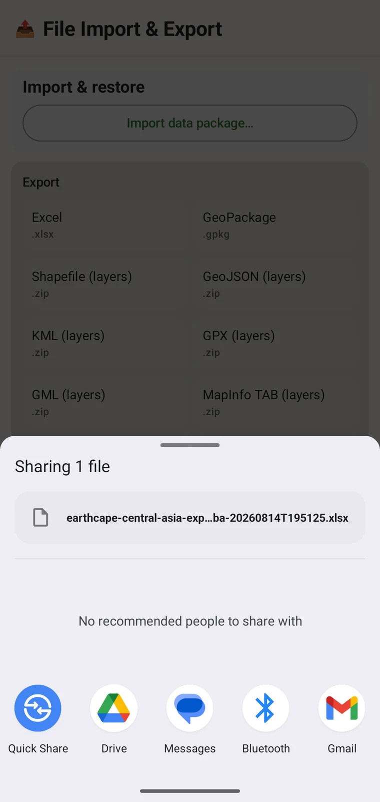
- When writing is complete, the Android share sheet appears so you can choose where the file goes. A Save to Downloads action is also offered if you prefer to keep the file on the device.
檔名依專案名稱與時間戳記產生,例如 earthcape-central-asia-exp…ba-20260814T195125.xlsx。每次匯出都會取得唯一的名稱,因此同一個專案重複匯出不會互相覆寫。
檔案會送到哪裡
Once the file is written, the Android share sheet opens with the usual destinations: Quick Share, Drive, Messages, Bluetooth, Gmail, and any other app registered on your device that accepts files. You can share the export immediately, or save it locally and upload later. If you have configured a cloud destination (see below), you can export the project there directly from its Integrations page instead of using the share sheet.
雲端目的地
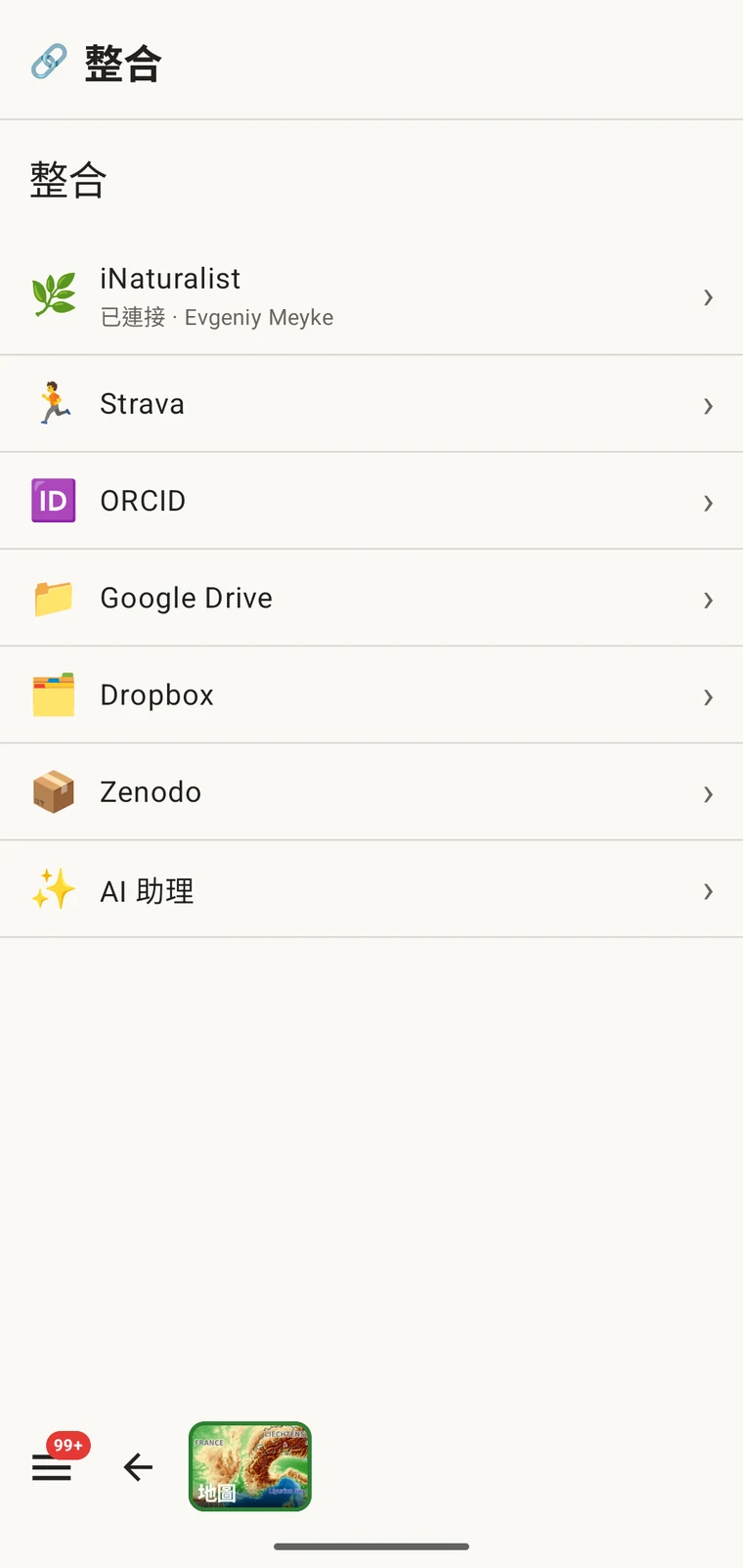
Three cloud destinations are available under Menu → Admin → Integrations: Google Drive, Dropbox and Zenodo. Open a provider's page to sign in and to export the current project there; the export screen itself writes local files only.
Google Drive 與 Dropbox 適合工作檔案與團隊協作:您把匯出結果放進共用資料夾,同事再取走。Zenodo 是 CERN 營運的研究資料儲存庫,會為每一次存放發給一個 DOI,因此適合作為與出版品一併發布、可被引用的封存資料。使用 Drive 的完整協作流程請見Google Drive 協作。
不會發布到 GBIF。EarthCape 不會直接把記錄提交給 GBIF。若要貢獻給 GBIF,請匯出 Darwin Core Archive,並透過您的機構或經 GBIF 認可的資料發布者提交。
專案套件:匯入與還原
畫面最上方的匯入資料套件…項目處理的是另一種檔案:專案套件。專案套件帶有一個專案的設定,包括它的調查方法、表單版面、自訂欄位與各項設定,因此您可以把設定好的專案交給同事,或把專案搬到新裝置而不遺失原本的設定。
專案套件與資料匯出不同。它們並非用於匯入 GIS 或資料儲存庫,而是用來把設定好的工作環境從一個安裝移到另一個安裝。自訂欄位定義、調查方法選擇與表單版面都會隨套件一起傳遞。自訂欄位如何運作請見表單與自訂欄位,調查方法的設定請見調查方法。
選擇格式
正確的格式取決於您要用這些資料做什麼。
| 目的地或用途 | 應選擇的格式 |
|---|---|
| 提交給 GBIF 或生物多樣性資料儲存庫 | Darwin Core Archive;若資料儲存庫要求,則使用 GBIF DwC-DP |
| 在 QGIS 或 ArcGIS 中開啟 | GeoPackage — 單一檔案,包含所有圖層 |
| 寄給使用試算表的同事 | Excel |
| 資料論文存放,或有綱要要求的資料儲存庫 | Frictionless Data Package |
| 完整備份,或搬到另一部裝置 | SQLite 備份 |
| GPS 裝置或其他軌跡應用程式 | GPX |
| 在 Google Earth 中檢視 | KML |
| 具 DOI、可被引用的封存存放 | 任何送往 Zenodo 的格式 |
離線作業
全部十二種格式都完全在裝置上寫出。匯出不需要連線:檔案由本機資料庫組成並寫入本機儲存空間。只有雲端目的地,也就是 Drive、Dropbox、Zenodo,需要訊號才能完成上傳。如果您在野外沒有連線,可以先匯出成本機檔案,等有連線之後再送到雲端目的地。